Need Geophysical services?
GEOPHYSICAL SERVICES
Geofocus Services
Geophysical Surveys
With a wealth of experience, an extensive inventory of equipment, and exceptional operational proficiency, GeoFocus offers cost-efficient solutions across their service offerings, which include Geophysical Surveys, Consulting Services, and Equipment Rental. By judiciously selecting the most suitable techniques and applying them with the right precision, we ensure optimal efficiency in our services.
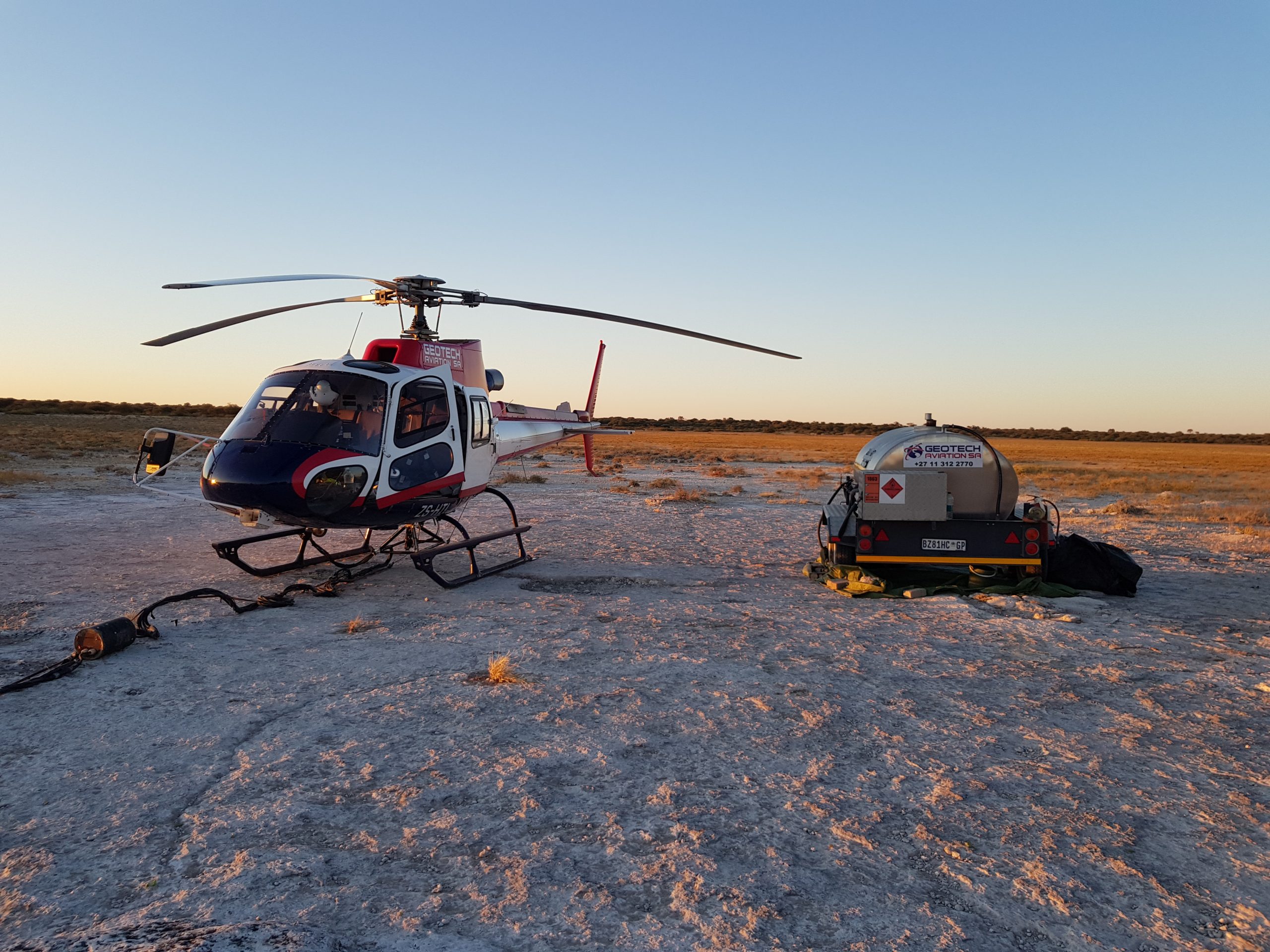
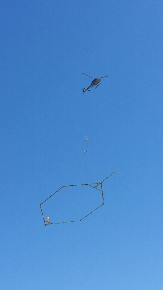
UAV Magnetics
Read More
- UAV Magnetics
- Lidar
- Orthophoto
- Magnetics
Unmanned Aerial Vehicles (UAVs) equipped with geophysical magnetic technologies have emerged as a transformative tool in mining exploration applications. By utilizing these UAVs, surveyors can rapidly and efficiently acquire high-resolution magnetic data over large areas, while maintaining a lower operational risk profile compared to traditional ground or manned aerial surveys. The magnetometers onboard these UAVs are capable of identifying magnetic anomalies associated with various mineral deposits, making this technology a valuable asset in direct detection and structural mapping. Additionally, the ability to safely operate at lower altitudes allows these UAVs to gather detailed magnetic data with greater precision. This use of UAV magnetic technologies in mining exploration not only accelerates data collection but also enhances the quality and accuracy of the acquired geophysical information, thereby contributing to more effective and efficient mineral prospecting.
Ground Gravity
Read More
Ground Gravity surveys play a crucial role in both exploration and engineering applications. This non-invasive geophysical technique allows us to detect subsurface density variations, thereby providing valuable insights into the geological structures and the presence of mineral bodies. It has a diverse range of applications from identifying potential resource deposits for mineral and hydrocarbon exploration to characterizing subsurface conditions for engineering purposes. Whether you’re seeking to discover new ore bodies or need to mitigate potential geological risks in construction projects, our ground gravity surveys provide the precision, detail, and reliability you need.
Ground Magnetics
Read More
Ground Magnetic surveys are a powerful and essential tool in exploration and engineering applications. This geophysical method is primarily used to map the magnetic properties of the subsurface, offering critical insights into the geological structure and composition. Ground magnetics can reveal the presence of ferrous minerals, aiding in the discovery of potential resource deposits for mineral exploration. On the engineering front, this technique helps identify subsurface features and anomalies, providing vital data for construction planning and hazard mitigation.
Electromagnetics
Read More
Electromagnetic (EM) surveys are a versatile and effective geophysical technique used in both exploration and engineering applications. This approach, which measures the response of the subsurface to electric and magnetic fields, allows for the identification of variations in subsurface conductivity. This information is invaluable in delineating ore bodies and hydrocarbon reservoirs, making EM surveys a pivotal tool in mineral and hydrocarbon exploration. Moreover, in engineering contexts, EM surveys provide crucial data on subsurface features, including groundwater presence and contamination zones, which inform the design and risk mitigation strategies for construction projects.
AMT/MT, Audio-Magnetotellurics & Magnetotellurics
Read More
AMT & MT survey techniques are key in mining exploration, providing deep insight into the Earth’s subsurface resistivity. By examining the Earth’s natural electromagnetic fields, AMT and MT reveal valuable information about geological structures and mineral bodies. These tools offer a comprehensive view of the subsurface, often leading to significant discoveries of concealed or deeply buried mineral deposits. At GeoFocus, our experienced team, equipped with advanced AMT and MT technology, delivers high-quality geophysical data that fuels discovery and aids in the efficient and effective exploration of mineral resources. Our commitment to data integrity and sophisticated interpretation means we provide actionable insights tailored to your specific mining exploration requirements.
IP – induced polarization
Read More
IP surveys are a crucial tool in the realm of mining exploration, helping to map the subsurface electrical properties of the Earth. This technique can effectively detect disseminated sulphide mineralization and is highly applicable to commodities like gold, graphite, and lithium. For instance, IP surveys have played an essential role in the discovery of several substantial gold deposits by identifying areas of disseminated sulphides associated with gold mineralization. Similarly, in the exploration of graphite and lithium, IP surveys have helped identify zones of potential mineralisation, underlining the technique’s versatility and effectiveness.
Resistivity
Read More
Resistivity surveys are a powerful tool for engineering applications, providing valuable insights into the Earth’s subsurface. This technique measures the electrical resistance of different subsurface materials, yielding crucial data that can inform the planning and design of construction and infrastructure projects. Understanding the resistivity of the ground is fundamental in identifying geological hazards, assessing soil composition and stability, locating groundwater and monitoring environmental conditions.
MASW – Multichannel Analysis of Surface Waves
Read More
MASW is a cutting-edge seismic survey technique that is crucial for engineering applications. It involves the analysis of Rayleigh wave velocity distribution, which provides a comprehensive profile of the subsurface shear-wave velocity. This information is invaluable when assessing soil stiffness and identifying different stratigraphic layers, enabling engineers to evaluate site suitability for construction, estimate foundation costs, and plan for potential geological hazards. It can also aid in the detection of voids and groundwater.
GPR (Ground Penetrating Radar)
Read More
Ground Penetrating Radar (GPR) surveys are a versatile and effective geophysical technique used in both exploration and engineering applications. This method uses high-frequency electromagnetic radar pulses to image the subsurface, providing critical insights into geological structures and lithological variations. In mineral exploration, GPR has been effectively applied to alluvial diamonds and gold, coal, bauxite and lead-zinc deposits in karst environments, iron and nickel laterites, as well as in the detection and mapping of shallow kimberlite dykes and pipes. For engineering purposes, this technique assists in locating underground utilities, cavities, and sinkholes, offering vital data for construction planning and hazard mitigation.

20180704_131531

20180529_162055

20180525_153430

20180525_140532

20180524_071925
20180524_071207

20170123_173720

20170123_173648 (1)
20160811_141233

20160811_140827
Contact Us
Need more info? Get in touch with us.
Office Location
South Africa
contactus@geofocus.co.za